
2026/09/22

A drone is flying at high speed through a 6,400 m² space.
Sometimes it flies alone; other times it takes off alongside multiple drones. It must constantly change direction and nimbly navigate around various obstacles in the field.
But for researchers, simply getting a drone to "fly" is not enough.
Where did it actually fly to? How did its posture change? How much deviation exists between its actual trajectory and the control commands?
Answering these questions requires a high-precision spatial measurement benchmark that is independent of the drone's own navigation and perception systems.
To this end, CHINGMU, in collaboration with the National University of Defense Technology (NUDT) , has built the largest large-space drone motion capture testing facility in the industry to date within a 6,400 m² three-dimensional space — providing unified, continuous external motion measurement data for unmanned systems research.
What does 6,400 m² actually mean?
Roughly one standard football pitch, about 15 basketball courts, or 64 homes of 100 m² each.
But the real challenge isn't just the size.
This is a three-dimensional space measuring 80 m on each side and over 15 m in height — drones must not only fly within a plane, but also continuously change altitude and posture along the vertical axis. Test flights in a small field and flights here are two entirely different matters. Once the space scales up to this size, a series of problems follows:
× Flying fast – With rapid acceleration and deceleration, a low frame rate turns trajectories into broken, intermittent segments, making precise error analysis impossible;
× Flying far or high – Toward the edges and at altitude, greater distance and smaller markers cause accuracy to degrade;
× Occlusion – During obstacle avoidance, a marker that gets blocked may cause the target to be lost instantly; and when several drones cross paths at high speed within the same frame, mutual occlusion compounds the chaos.
In a space that is exceptionally large, tall, densely cluttered with obstacles, and where the number of targets varies with each mission — how do you continuously "see" drones moving at high speed?
This cannot be solved by simply "installing more cameras." What CHINGMU set out to do was establish a unified, continuous, and reliable 3D spatial coordinate system for drones within a 6,400 m² space.
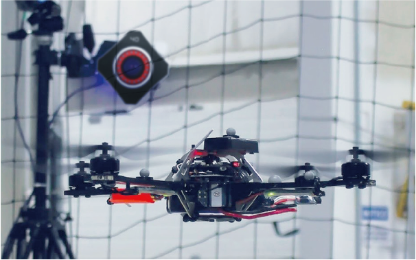
To address this three-dimensional space with a 15 m ceiling height and numerous obstacles, CHINGMU deployed multiple K (Kunpeng) Series optical motion capture cameras, building a capture network that covers the entire experimental area for real-time localization and posture tracking of drones.
Solving the "Large-Space" Challenge: Ensuring High Precision Across the Entire Field
Large-space high-precision pose measurement: Achieves 3D localization and 6DoF pose solving within a complex outdoor space, providing a stable and unified external ground-truth reference for unmanned systems testing.
Full-field accuracy consistency: A proprietary calibration algorithm compensates for camera distortion and spatial errors, resolving the issue of "rapid accuracy degradation at edges and high altitudes" once the space is scaled up.
Online continuous calibration: Anchor points are continuously calibrated online, gracefully handling camera pose changes caused by structural micro-vibrations and long-term operation, improving the stability of field testing.
Solving the "High-Speed" Challenge: Capturing Continuous Trajectories
High-frequency dynamic capture: Continuous sampling at high frame rates delivers real-time output of dynamic parameters including position, posture, acceleration, and angular velocity — turning high-speed motion from broken, intermittent segments into continuous, precisely computable trajectories. This meets the requirements of motion control algorithm validation and dynamic performance analysis.
Solving the "Multi-Target & System Synergy" Challenge: Connecting the Data Chain
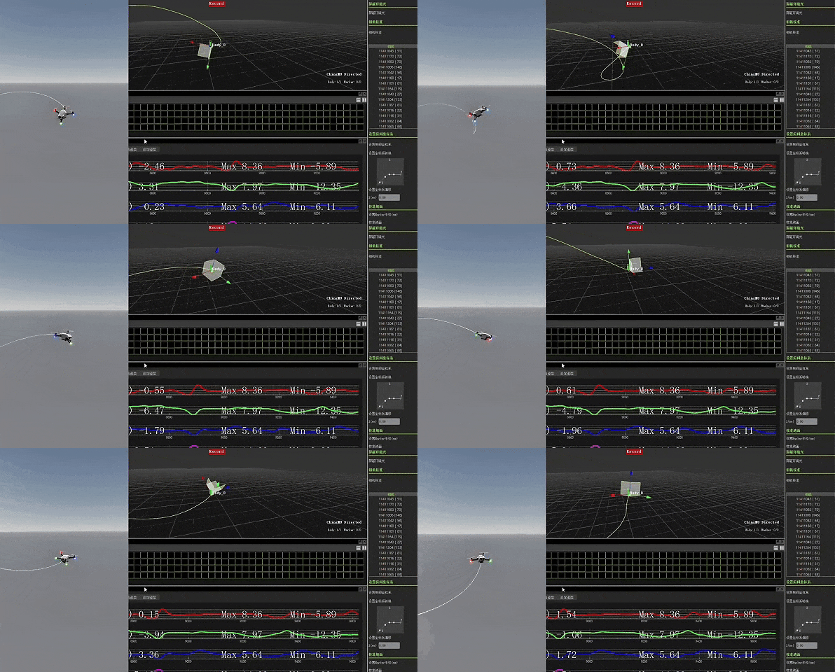
Unified multi-target coordinate tracking: Supports synchronized measurement of multiple drones, outputting pose relationships in a unified coordinate system, continuously distinguishing between different targets and recording relative position changes.
Multi-system spatiotemporal alignment: A synchronization unit achieves temporal alignment, while a coordinate transformation matrix ensures spatial unification — enabling pose, force, control, and other multi-source data to be analyzed within the same framework.
Enhanced interference resistance: Intelligently filters out noise, effectively addressing mutual occlusion when drones cross paths in flight.
Solving the "Abstract Data" Challenge: Making Motion Trajectories Visible
In CHINGMU's motion capture software CMAvatar, researchers can view a drone's position, posture, and complete 3D motion trajectory in real time, and further obtain dynamic parameters including velocity, acceleration, angular velocity, and angular acceleration. Scattered flight data is thereby transformed into a motion process that can be intuitively observed, quantitatively analyzed, and repeatedly verified — truly realizing the conversion from "abstract numbers" to "analyzable motion data."
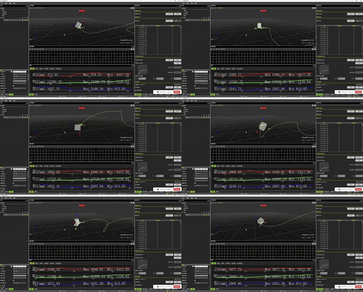
Ultimately, this system forms a complete research loop:
Control → Flight → Measurement → Comparison → Analysis → Optimization
A drone's own navigation, inertial navigation, and control systems continuously output its state information. The optical motion capture system, meanwhile, provides a separate set of external motion measurement results that are independent of the tested system's own estimation. By comparing the two, researchers can further analyze:
The deviation between control commands and actual execution;
The error between onboard positioning and external measurement;
The true motion performance under different algorithms and different flight strategies.
In this project, therefore, the motion capture system is no longer merely "recording drone movement." It acts more like an external spatial measurement ruler for the entire testing facility, providing an objective Ground Truth reference for unmanned systems algorithm research and performance validation.
Challenging the "Impossible": CHINGMU's List of "Extreme Mocap Scenarios"
6,400 m² is already enough to put a motion capture system to the test.
But for CHINGMU, this is not the first time stepping into high-difficulty scenarios. In one real-world, high-difficulty project after another, CHINGMU's camera arrays have long since penetrated various "unconventional battlefields" and become the preferred choice for research users.
80 m/s hurricane-force wind environment: AVIC First Aircraft Institute — dynamic measurement under extreme high-speed airflow conditions;
Complex outdoor environment: CISDI — real-time pose tracking for outdoor unmanned excavators;
High/low-temperature precision measurement: AVIC Chengdu Aircraft Design and Research Institute (Institute 611) — high-precision measurement of aircraft positioning pins under high/low-temperature environments;
In the project of Li Zhihai's research team at the Shenyang Institute of Automation, Chinese Academy of Sciences (SIACAS) , CHINGMU's mocap served as core data acquisition support, helping related research be published in Measurement, and validating that CHINGMU's optical dynamic measurement accuracy has entered the sub-millimeter stage.
The problems faced by these scenarios are not the same: some involve high-speed airflow, some complex outdoor environments, some extreme temperatures, some high-precision scientific measurement, and some large-scale multi-target real-time capture.
But they all point to the same question: when the space is larger, the targets faster, the environment more complex, and the measurement requirements higher — can the mocap system still stably output reliable data?
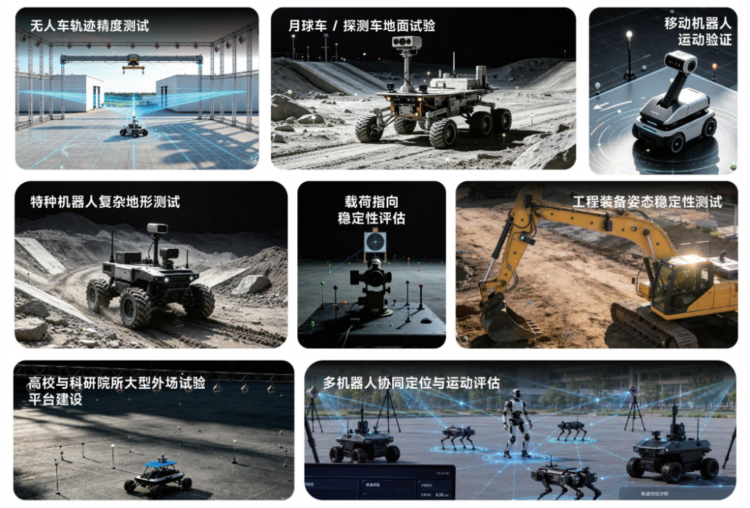
Behind these seemingly different cases lies a common reality: the growing demand for motion capture in scientific research and industrial applications is becoming increasingly real and increasingly complex.
CHINGMU has always believed that true research-grade capability is never just about parameters measured in a laboratory. It is about being able to deliver a "ruler" that can be trusted in places that are larger, faster, more complex, and less tolerant of error. So that every motion in the real world can be accurately seen, reliably measured, and ultimately become truly valuable data in the hands of researchers.
This time, the 6,400 m² large-space drone motion capture testing facility is up and running.
Next time, where else will CHINGMU bring this "ruler"?
CHINGMU: The "Electronic Referee" Behind Robot Competitions
On September 23 the 5th Global Digital Trade E...




+86-21-56472866 / 13310099680
1190 Nong METACINE (South Gate), Building 1, CHINGMU, Zhengtai Road,Baoshan District, Shanghai

Hot searches: Motion capture, Optical motion capture, Motion capture system robot, Motion capture, Bionic robot, Motion control, Gait analysis, Rehabilitation training action assessment, Animation production, Virtual idol live streaming, Expression capture, Virtual production, Pre-visualization, Performance capture